Waterfront in Harpswell can look simple at first glance: a quiet cove, a long view, maybe a float at the shore. But here, the real story is often in the tide line, the road in, and the exact rights that come with the property. If you are thinking about buying waterfront in Harpswell, you need more than a pretty photo. You need to understand how coves, tides, access, and working-waterfront rules shape daily use and long-term value. Let’s dive in.
Why Harpswell Waterfront Is Different
Harpswell is one of Maine’s most shoreline-rich towns. The town says it has 216 miles of coastline, and no place in town is more than a mile from the coast. It is also an active working waterfront, with more than 275 licensed lobster harvesters and more than 50 commercial shellfish harvesters, which means waterfront property here exists alongside real marine use, not just recreation. You can explore that local context in the town’s waterfront usage overview.
That matters when you buy. In Harpswell, waterfront value is influenced by your view and frontage, but also by access rights, nearby harbor activity, permitting, and the town’s efforts to balance residential use with commercial marine needs.
Harpswell’s housing mix adds another layer. The town’s 2025 draft comprehensive plan says most housing is owner-occupied single-family homes, while about 34% of housing units are seasonal or vacation homes. You can see that pattern in the town’s draft comprehensive plan materials.
Coves vs. Open Exposure
Sheltered coves can be calmer
Many buyers are drawn to coves because the water often feels more protected and private. In practical terms, sheltered areas may offer calmer conditions for small boats, kayaking, and day-to-day waterfront use.
But a sheltered setting can come with tradeoffs. Some Harpswell coves become very shallow at low tide, and some areas turn to mud flats toward the inlet. That can affect whether you can launch a boat, reach a mooring easily, or enjoy the shoreline the same way at every stage of the tide.
Busier harbors have different dynamics
Harpswell’s water classification definitions help explain what different waterfront settings may feel like. Type 1 waters are generally lower-intensity areas with features like shallow water, mud flats, and exposed shoreline, while Type 4 waters are busier commercial and recreational harbors where space can be tight and uses overlap.
The town’s coastal-water management plan gives real-world examples. Gun Point/Mill Cove is described as a long, narrow harbor with mostly residential moorings. Orr’s Cove is narrow and recreational. Brickyard, Rich, and Mill Coves can become quite shallow. Cundy’s Harbor is a fully developed working harbor with commercial fishing docks, shops, restaurants, a library, and a mooring field near capacity.
More exposure can mean more wear
Some waterfront properties offer broader views and less congestion, but they may also face more wind, surge, and seasonal shoreline wear. Harpswell’s official documents do not label areas as “open ocean,” but the town’s exposed-shoreline classifications point to the same practical difference: the more open the setting, the more important exposure becomes.
Tides Matter More Than You Think
Harpswell follows Maine’s strong tidal pattern
Maine tides are semi-diurnal, which means you get two high tides and two low tides in about 24 hours. According to the Maine Geological Survey’s marine FAQ, spring tides are typically 10% to 15% larger than the mean range.
In Harpswell, that is not just background information. Tides affect how much water you have at the end of a dock, how easy it is to reach a mooring, whether a shoreline path stays usable, and how a cove looks and functions from one part of the day to the next.
New mapping changes the conversation
Harpswell says it adopted new FEMA Flood Insurance Rate Maps in June 2024, replacing much older maps. The town also notes that it now uses NOAA’s Highest Astronomical Tide datum, based on Portland calculations, as part of its shoreland ordinance framework. You can review those updates on the town’s climate resilience and flood information page.
The same town page says tides in Portland Harbor have risen 7.5 inches since 1912 and highlights places where flooding already occurs when storms line up with spring or king tides. For you as a buyer, that means lot elevation, shoreline type, and the height of your access points deserve close attention.
Access Is More Than Waterfront Frontage
Deeded access should be verified
In Harpswell, not every shoreline access point is simple or permanent. A draft 2025 town inventory identified 83 shoreline and intertidal access points, but 57 were on private property, 17 were municipal, 6 were land-trust owned, and 3 were state-owned. The same inventory says many access points rely on informal agreements, and 12 had already been lost. That information appears in the town’s background inventories for the comprehensive plan.
For a buyer, the lesson is clear: do not assume that a path, landing, or shoreline use is guaranteed just because it has existed for years. You want written clarity on deeded access, easements, and any formal agreements tied to the property.
The road to the water matters too
Harpswell says 63% of the town’s roads, or 96.7 miles, are privately owned. That means owners, not the town, are responsible for maintenance, resurfacing, stream crossings, and plowing on those roads. The town outlines those realities on its roads and infrastructure page.
That page also says many bridges and stream crossings over salt marshes and coastal wetlands were not built to handle the ebb and flow of tides. The town identifies seven public roads and landings expected to flood with 1 to 2 feet of sea-level rise by 2050, including Abner Point Road, Basin Point Road, Bethel Point Road at Hen Cove, Dingley Island Road, Garrison Cove Road Landing, Lookout Point Road Landing, and Lowell’s Cove Road.
If you are comparing two waterfront homes, a dependable road with clear maintenance responsibility may matter just as much as frontage length. This is especially important if you plan year-round use, host guests, or need reliable access during storms and winter weather.
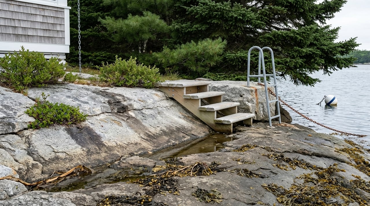
Moorings, Docks, and Wharf Questions
Moorings are regulated locally
Harpswell regulates moorings through its Harbor and Waterfront Ordinance. The ordinance says moorings below the lowest annual tide must be registered with the Town Clerk, and the Harbormaster assigns mooring space on a first-come, first-served basis as space allows. The town also notes that, when practicable, shorefront owners can be assigned one mooring fronting their land if they request it. You can review those rules in the town’s Harbor and Waterfront Ordinance and on the mooring information page.
In denser coves, there may be waitlists. The ordinance also shows that rental, service, and float moorings can require U.S. Army Corps of Engineers permits.
Existing structures still need review
If a listing mentions a dock, float, wharf system, or shoreline improvements, it is smart to verify permitting early. Harpswell’s Code Enforcement Office issues permits for land use, structures, floodplain work, septic systems, and wharf systems.
That means your due diligence should cover what exists now, what was approved, and what changes might require future review. A waterfront setup that works for one owner may not automatically support your plans.
Working Waterfront Affects Daily Life
Harpswell actively supports its marine economy and working shoreline. That is part of the town’s identity and part of what makes many areas feel authentic and alive. You can see that commitment on the town’s working waterfront page.
For buyers, this means it is important to understand nearby activity before you fall in love with a property. A harbor may include fishing docks, commercial boat traffic, gear storage, or busy seasonal patterns. That is not a drawback for everyone, but it should match how you want to use the property.
Rental Potential and Resale
Harpswell’s seasonal-home base can make waterfront attractive to second-home buyers and investors, but not all waterfront properties perform the same way. Based on the town’s housing materials and waterfront rules, practical features may shape resale and rental appeal more than water frontage alone.
Features worth weighing include:
- Reliable year-round road access
- Clear deeded shoreline access
- Usable waterfront at different tide levels
- A straightforward permit history
- Practical parking and loading areas
- A location that fits nearby harbor activity
If you are buying with future flexibility in mind, those basics often matter as much as the view.
Your Harpswell Waterfront Checklist
Before you move forward on a Harpswell waterfront property, make sure you verify:
- Deeded shoreline access and road access
- Whether access is formal, informal, or easement-based
- Private-road ownership and maintenance obligations
- Road association dues, plowing, and bridge or culvert responsibilities
- Floodplain, shoreland zone, and Resource Protection status
- How updated FEMA maps and tidal boundaries affect the lot
- Current mooring status and any waitlist position
- Whether docks, floats, or wharf systems have permits
- Whether future marine improvements may need local or federal approvals
- How nearby working-waterfront activity may affect day-to-day use
Buying waterfront in Harpswell is often less about finding the most dramatic listing photo and more about matching the property to the way you want to live on the coast. If you want help sorting through coves, access questions, remote tours, or the practical side of a waterfront search, Paul Clark can help you evaluate the details that matter before you commit.
FAQs
What should you verify before buying waterfront in Harpswell?
- You should verify deeded shoreline access, road access, floodplain and shoreland status, mooring availability, and permits for any dock, float, or wharf system.
How do tides affect a waterfront property in Harpswell?
- Tides can affect water depth, shoreline usability, access to moorings, and flood risk, so a property may function very differently at low tide, high tide, and during spring tides.
Are all Harpswell waterfront roads maintained by the town?
- No. Harpswell says 63% of its roads are privately owned, so buyers should confirm maintenance responsibilities, plowing, and any road-association obligations.
Can you assume a Harpswell waterfront property comes with a mooring?
- No. Moorings are regulated by the town, space can be limited, and some areas have waitlists, so you should confirm the status directly.
Do sheltered coves in Harpswell always offer better waterfront use?
- Not always. Sheltered coves may have calmer water, but some also have shallow approaches, mud flats, congestion, or private-access limitations that affect use.